Start: Yosemite Valley (off trail) – Mile 942.5 End: Glen Aulin Campground – Mile 948.3 Elevation Max: 9,570 Elevation Min: 7,462 Elevation Change: 347 up & 1,588 down Average Heart Rate: 99 Walking Time: 2 hrs 15 minutes Date: 6/10/2022
The Walk
I had a blast in Yosemite, but it was time to go. I was ready to get back on the PCT and make some miles toward Canada.
We weren’t in a rush, so I hung out in the park looking for decent Wi-Fi or cell service. I even tried to go to the Awhanee hotel and check the Wi-Fi. I saw a young guy with headphones in a sitting area and got the password from him.
He was living in the park and climbing. Surprisingly even the hotel internet wasn’t good. So I gave up. I grabbed lunch at 2 and hopped on a bus to the west side of the park, I needed to hitch over an hour to Tuolumne Meadows.
The buses were running slow and I got to the drop off around 3:30. CJ and high life were at the road with their thumbs out! I thought they had already left.
As soon as I got to the road a car pulled over and gave us a ride. He was headed to Sacramento and went 45 minutes out of his way for us.
As we walked up to the post office, they were shutting their doors. But they stayed open a few extra minutes for us and gave us the packages. Perfect!
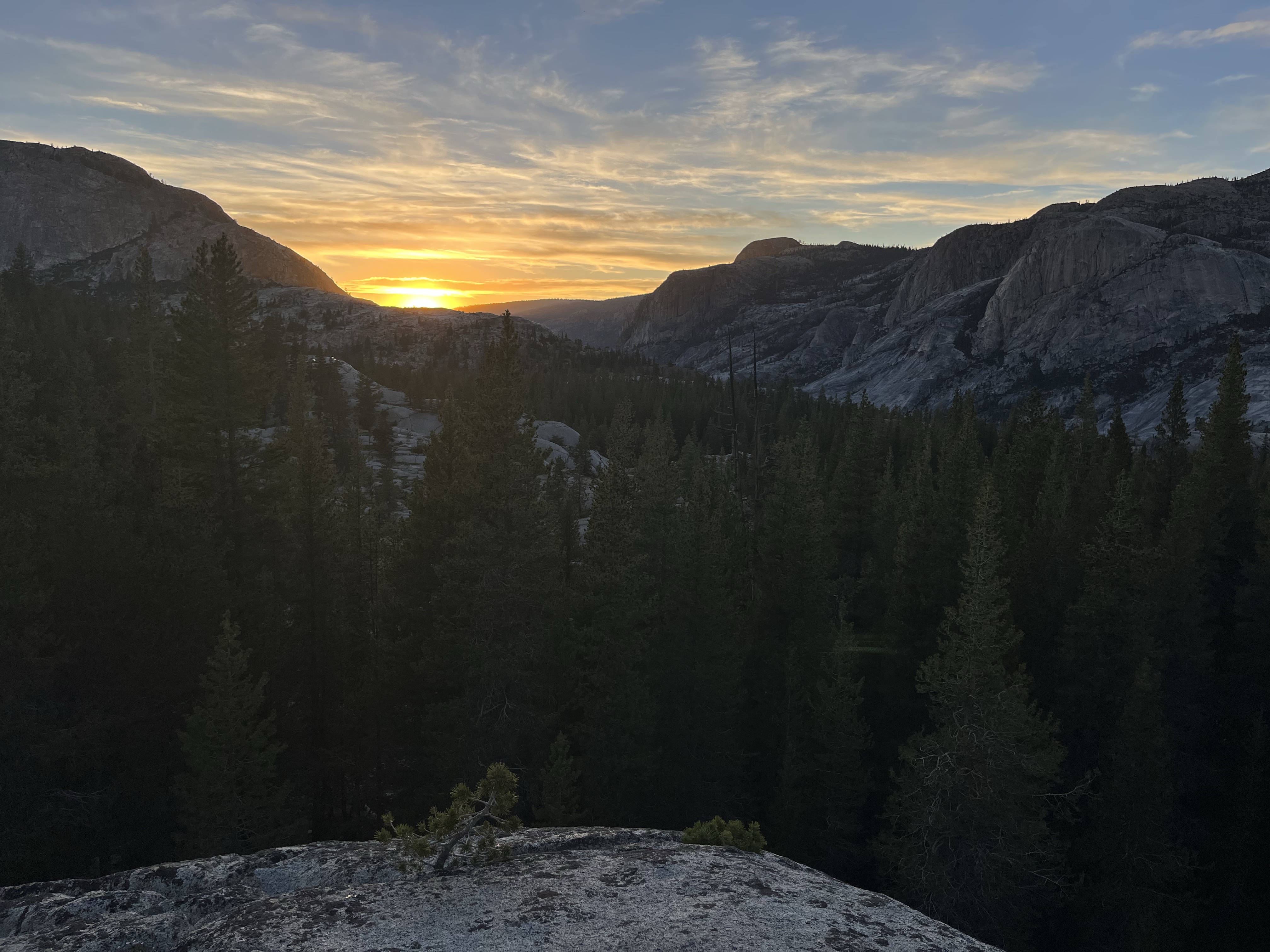
I had plenty of food and headed to the trail. The hike with Quest and High life was pretty easy. We hiked 6 miles to Glen Aulin and passed a few powerful falls along the way.
I’m excited for the last section of the Sierras and to see what comes next. Kennedy Meadows is the next stop in a few days. I’ll get rid of my bear can and maybe microspikes! Woo! Can’t wait for a lighter pack 🙂
Start: Yosemite Valley (off trail) – Mile 942.5 End: Yosemite Valley (off trail) – Mile 942.5 Elevation Max: 7,035 Elevation Min: 4,480 Elevation Change: 2,977 up & 3,017 down Average Heart Rate: 111 Walking Time: 2 hrs 19 minutes Date: 6/9/2022
The Walk
I had a relaxing day in Yosemite. Part of it was figuring out the bus system and getting accustomed the park.
We moved our stuff from Backpackers Camp to camp 4. We stuffed our gear in a bear box and hiked up Yosemite Falls with just a liter of water.
The hike up felt easy. It was weird hiking without a backpack. I felt super light and we all cruised up the climb. You could see glimpses of the waterfall during the 3.2 mi climb. And at the top it was rushing!
There was even a section where the trail was sprayed by a cool, misty wind from the falls.
At the top we found a place to soak our feet and legs. It was sunny and a perfect place to relax in the sun. Around 1:30 we realized we needed to find a camp spot. I refilled water and headed down.
The down was harder than the up. 80% of the trail is sandy stair steps. You had to be careful or your foot would slide on the sand. Which made quickly walking down them a dangerous option.
I switched back and forth between walking slow and fast. It was nice to have a bit of Wi-Fi to catch up on internet things. After that we found a tent spot, grilled brats and chilled for the night.
We got down and headed to the market. I wanted to grill out. We got a spread with brats and veggies. Then had a grill out and bonfire at the camp site.
I woke up on top of clouds rest. Last night was a weird sleep. There were critters all around. About 10:30 I thought I heard some scratching and saw a shadow but as I looked everything was quiet. A minute later a chickadee came stole a page out of Quest’s book!
He woke up and I threw a rock at the thing. It didn’t make it far with the paper. Quest got it back, but then the next few hours I laid there wondering which animals were coming next.
None of my stuff was attacked in the night! We had a quicker start to the morning to get to half dome. It was a 5ish mile walk to the trail then a 2 mile climb. The hiker we met last night gave me a homemade oatmeal packet with lots of good stuff in it. Seeds and dried raspberries.
I ate that and headed down the mountain. The trail went right over the mountain cliff, which was really cool to see. It was steeper than most of the PCT. We walked down and got a good look at half dome.
The trail went down switchbacks. It was a nice morning climb. We filled up a 2 liter with water. The only water we could carry and kept moving.
The half dome trail was steep most of the way. And once we got to the base of half dome our permits were checked. The ranger gave us gloves and we started climbing stone steps. 6-700 feet of climbing later we were up at the next part.
This part was really steep. Uncomfortably steep. But I enjoyed it. Some people used a tether to make sure they didn’t slip and fall. But quest and I cruised right up. At this point I am used to walking / climbing around and am comfortable with my steps.
We climbed up the last section and got to the top. The face of half dome is a sheer drop! Lots of tourists were up there which was a very different change of pace. But it was a fun climb and a cool view.
We descended and decided burgers were up next. 5 more miles into Yosemite Valley. There a public shuttle to take us to different areas. The trail down passed two huge waterfalls! I had seen a lot of smaller ones in the sierras, but these were powerful.
The water blasted off the mountainside and we must have seen hundreds of other hikers. This 2.5 mile loop is really popular. It had quite a bit of elevation, but it is worth the effort.
At the bottom we walked to backpackers camp, claimed a spot and found the shuttle to a burger. Quest and I met up with Detour, Mounty, and High Life. It was super random that we met up. They were waiting at a bus stop when we arrived on the bus. Then we all hang out and got dinner.
I got a burger, soup and salad. I ate it all and it was a mistake. I was way too full for an hour before the food digested.
After that we headed back to camp and relaxed. I’m not sure what tomorrow holds. Maybe a day hike up to Yosemite falls and Yosemite point. I’d like to relax a bit because I’ll start crushing mikes back in the PCT!
Another easy morning. I woke up and didn’t worry about moving quickly. Cathedral lake was still beautiful. I ate breakfast and relaxed. I did yoga and mediation on top of the ridge overlooking the lake.
Then I took my air mattress down to the lake to search for a leak. I patched it once in Mammoth, but it still was leaking. Last night I had to blow it up twice in the middle of the night. And by 7:30 I was touching the ground.
The lake wasn’t moving. Which is exactly what I need. It’s tricky to find a leak in moving water. Because you need to be able to see bubbles coming up out of the water.
I put the air mattress in to check if my patch was leaking. It wasn’t. But there was another leak close by! Perfect. I checked the rest and didn’t see anything. So I climbed back up to the camp spot and patched the second hole. Hopefully tonight I’ll get a full nights sleep.
We planned to get to clouds rest and maybe do half dome. Depending how we felt. Around 10 we actually got out of the lakes and headed out for the day.
Most of the day was walking through a mix of forest and meadow. Pretty mild. Until we took the sunrise lakes side trail. That was a break from the JMT. We started to climb up to the lakes.
At the first lake I noticed a lot of mosquitos when we stopped, so we kept moving. They will probably be everywhere. The third lake was smaller and hopefully warmer, so we kept waking.
At the third lake we found a nice flat rock to relax at. Except the mosquitos were everywhere. I think the bug spray I used helped a little bit, but I could hear them buzzing around in my ear. And see them all around my legs.
I never stopped moving around and then quickly jumped in the water. I’m not sure when the next shower will be, and a lake soak is better than nothing. Plus it felt nice once I got out and over the shock.
I kept pacing around and snacked. We headed out after 30 minutes because we were sick of swatting at the mosquitos. When you are walking they aren’t too bad. Plus I reapplied spray after getting in the water and it seemed to help.
After the lake we hiked up to clouds rest. I didn’t expect much when we got here. I expected a normal mountain, where I’d look at some cool views then move right along.
But this 360 degree view was amazing. There was a perfect view down into Yosemite Valley and of half dome. Plus the sun set would be epic. It was only 3:30, but we decided to call it and camp here. The only problem was water.
Quest had a liter and I had about 4 gulps. I hadn’t planned to camp here, so I didn’t think about water. The closest water was 3 miles back down a steep climb. I didn’t want to do that.
So we decided to try snow. Quest filled up a 2 liter cnoc with water and we waited for it to melt. Rubbing it at times to speed up the process. It was working, but slowly. So I tried to boil some snow.
The problem with my idea was that my pan wasn’t clean. It had cheesy rice left over from last night. And when I put the snow in I turned the boil on too fast. And it burnt the crap out of the old rice.
The snow in my pot eventually melted, but it tasted terrible. It was like vomit. I filtered and gave it a taste and it was just as bad. Now I’ve ruined two water bottles and I can’t boil dinner. Haha.
As we were wondering what to do I saw some snow melting on the side of the mountain. It was tricky to get to and I would have to climb down 100 feet. But possible.
So once the first batch of snow melted I went for the snowmelt. The climb down was slow and tricky. But I got there. And 10 minutes later I had a full two liter of water. We filtered it and prepped dinner (cold doaking). And I went to get one more fill up. That would be plenty.
I got back then relaxed and watched the sunset. My cold soaking was a disaster. I soaked 69 cent Mac and cheese for 3 hours (way too long, and it turned to mush). Then I didn’t soak the cheesy rice long enough. I ended up eating crunchy cheese rice. Because I was hungry and didn’t want to wait.
What a great night. We made it work and got to camp out on an epic spot. It’s a sunset I’m never forget! Now a few mosquitos are buzzing and landing on my hand as I type. Hopefully they will go away and leave me alone. Also hoping my air mattress stays inflated all night!
Start: Tent site before Donahue Pass – Mile 926.5 End: Cathedral Lakes (off trail) – Mile 942.5 Elevation Max: 10,944 Elevation Min: 8,551 Elevation Change: 3,085 up & 3,418 down Average Heart Rate: 118 Walking Time: 7 hrs 51 minutes Date: 6/6/2022
The Walk
I woke up and pulled my sleeping bag over my head. The sun was up early today and warmer than anytime yesterday. What a great sign for the day. I checked the weather and it said high of mid 60s!
I took a really easy morning and had breakfast. Enjoying the sun rays. At least four groups of hikers walked by while I was laying down or eating breakfast. Finally at 9:00 quest and I were packed up and ready to go.
We had the last major pass today. 3 miles away from Donahoe Pass. It isn’t the talkest or very steep, but it’s known for holding lots of snow and postholing. It was close to freezing last night. So I was happy to wait and give any icy rocks time to thaw.
We headed out and started the gradual climb up Donahoe Pass. It was around 1.5k feet over the three miles. Not bad at all. I was surprised to see no snow the first two miles. There was quite a bit of running water and the trail was often filled with water.
So I got practice jumping from rock to rock, trying my best to keep my feet dry. I did pretty good. The last mile was snowy and we followed footsteps when possible. A few times I used a map and the compass on my watch to orient and see which direction to go. The tall mountains help make that easy.
We were at the top in an hour and enjoyed the views of the last major pass. Crazy! The valley below was the most dense forest we’ve seen. I headed down the pass skidding along the snow.
Soon the trail was covered in water again. We had a 6.5 mile descent then a 6.5 mile flat walk.
The descent was filled with small water crossings. And the mosquitos picked up. They didn’t bother me much while walking, only when I’d stop to take a break. So that meant not many breaks.
The flat section was a welcome change. We hadn’t had a flat section that long for hundreds of miles. So we cruised and I threw in some music.
On the day we must have done 100 water crossings. Most of them were pretty small, one or two hops over. It was fun but exhausting. My feet were sore at the end of the day from all the rock hopping.
The walk was nice and we made it to the Tulomne ranger station 15 minutes before 5. Just in time to get our permits for Yosemite.
The rangers were nice and gave us a tip on an epic camping spot at Cathedral Lakes. We had to hurry because it was a mile road walk then 4.5 miles of trail. We headed out and soon realized it was also 1.5k feet of climbing.
We made it to the upper Cathedral lake and considered stopping. A ridge was another 100 feet up and I was hungry. But screw it. I might only be here once, and the ranger said the spot was great. Up we went. And I didn’t regret it.
Dinner and a sunset were divine. I had Annie’s rice and cheese from the Grocery outlet with some couscous and a few chunks of cheese cheese. Quite a combo.
I watched the sunset then got into my sleeping bag and waited for the stars to come. The sun doesn’t fully set until 9:30. The moon is almost half full, so the nights are getting brighter.
Start: Johnston Lake – Mile 910.5 End: Tent site before Donahue Pass – Mile 926.5 Elevation Max: 10,137 Elevation Min: 8,127 Elevation Change: 4,663 up & 3,804 down Average Heart Rate: 130 Walking Time: 6 hrs 23 minutes Date: 6/5/2022
The Walk
I woke up to pattering on my tent. The mist was still coming down. With a few raindrops. I checked outside and it was super overcast. The sun didn’t have a chance to start shining.
That made for a lazy morning. I had a bar of service, so I was able to relax and catch up on some internet things. Around 8:30 the rain didn’t seem to be picking up so I decided to head out.
We weren’t doing any passes. Just planning to get close to Donahue Pass. The morning walk was through overcast forest, hoping over creeks and walking over logs. The snow was melting. Doing the Sierras a few weeks apart would be a completely different experience.
I’m happy with the timing we had. I got to experience the snow, didn’t posthole too much and didn’t have many sketchy sections where I thought I could fall and hurt myself. We were walking on the JMT section. And passed by a few lakes.
I stopped at one for lunch. And found a good rock as a backrest. It chilly so we didn’t break too long. I had to put on my puffy when the body heat from hiking wore off.
After lunch was more dodging puddles and creek crossings than anything else. The sun was battling the clouds, but the clouds were winning.
We climbed toward Donahue Pass and mountain tops came into view. They were shrouded in clouds.
I’m the afternoon we passed Garnett lakes, the first of two lakes. I got off trail at one point it was mostly snow all around. And started making my way down the mountainside. I knew I was off trail, but didn’t really care. I could see where the trail crossed the lake and knew I just had to get down.
So I spent a half mile finding the best way down the mountain. Skidding down snowy descents, jumping over creeks, and climbing down loose rocks. It was a fun detour.
The next lake was much simpler. Thousand island lake. I didn’t have a great view until we passed it and started climbing up thousand island pass, then the view back was great.
I chatted to a few JMT soon hikers. They were all just starting out. About 50 miles into their trip. It was cool to see their excitement and awe at the beauty around.
I walked the last few miles and camped about 3 miles from Donahue pass. That would make for an easy morning over the pass and set us up well. Tomorrow we’ll try to get into Yosemite and pick up permits. Hopefully it will warm up a bit!
Start: Mammoth Lakes- Mile 906.6 End: Johnston Lake – Mile 910.5 Elevation Max: 9,177 Elevation Min: 7,617 Elevation Change: 1,382 up & 2,237 down Average Heart Rate: 105 Walking Time: 3 hrs 12 minutes Date: 6/4/2022
The Walk
The motel bed was nice to wake up in. There was plenty of food around. I had Frosted Flakes. Then headed to the coffee shop to hang out use the internet for awhile.
Yesterday was a relaxing zero. I left the room twice. Once for laundry and once for resupply. I felt good this morning and we weren’t in a hurry. We could pick up our Yosemite permits near Tullome Meadows in 2 days.
It was only 35ish Miles away. So we didn’t even need to get very far today. Maybe 5-10 trail miles. But we did have to get back on the trail. That takes two bus rides and a 5 mile side trail.
I had a relaxing morning until 11 at the hotel and went to a juice shop for a few hours. Around 1 we left to catch the first bus. It runs every 30 minutes. As we walked out of the parking lot I saw the bus coming on the other side of the street. It was stopping almost directly across from us.
We ran and waved our hands. Almost touching the end of the bus when it took off and left us. Crap! Now we’d have to wait 30 minutes for a ride.
Before we could say anything a white suv pulled up and asked if we needed a ride to trail. Sure! We hoped in with a lady who had hiked the JMT 10 years ago. She said she would take us up to Reds Meadows. Couldn’t be better. That would save us 5 miles of hiking back to the PCT.
We arrived at the mammoth mountain ski resort and she said the shuttle stop is here. And she needed to get back to town. But we all realized the shuttle wasn’t running, she didn’t have time to take us anywhere else, so we were stuck.
We pulled out maps checking for trails down to the PCT. One ski worker came over and offered to take us to the closed road. It’s our best option and about a 7 mile mix of trail and road walking.
He dropped us off and we took a 2 mile wooded trail down to a few miles of road walk. Then to Reds Meadows. All in all it wasn’t too much longer than our other plan of 2 busses and a 5 mile trail.
We got back on the PCT at Devils Postpile National Monument. Climbed to the top and then walked in front of it. It’s a rock structure crated by glaciers and lava. It was an awesome welcome back to the PCT.
We hiked for a few more miles and we’re both tired. At about 10 for the day we decided to camp and call it. The map had a Johnston lake, which was more of a mosquito pond. But we found close spots nearby.
As I set up my tent I counted 7 of them buzzing around my legs. I made it in with only a few bites. I ate dinner in my tent away from the mosquitos and called it a night. Tomorrow would be a longer day of hiking.
Start: Duck Creek – Mile 895.8 End: Mammoth – Mile 906.6 Elevation Max: 10,128 Elevation Min: 7,774 Elevation Change: 2,187 up & 3,145 down Average Heart Rate: 122 Walking Time: 5 hrs 1 minutes Date: 6/2/2022
The Walk
My sleeping pad definitely had a hole in it. I woke up 3 times last night to blow it up. It only takes 10 blows to get back, but it’s annoying! I’ve dealt with this for the past week. Hopefully I can soak it in the motel 6 bathtub and find the hole.
The morning was brisk. As I packed up a few hikers walked 20 feet by across the snow. We are close to the trail. Woo! I wasn’t sure last night because it was getting dark and we were sliding around on the snow.
Today was a pretty chill day. 11 miles to Reds Meadow then a 4 mile side trail to Mammoth. Reds Meadow is a resort right next to Devils Postpile. An unusual rock formation of columnar basalt and a national monument. Usually Red’s is a great spot for hikers to hang out and resupply. But it’s still closed! Maybe too much snow in the area?
We walked the 11 miles and enjoyed the forest. The second half of the walk was filled with pine trees. They didn’t look real. They looked like the plastic figure ones with perfect spacing and needles. Weird. Maybe these are the trees the toys were modeled after.
Most of the taller trees had burned or fallen down. So only the pine trees were left. We soon came to the horse ranch and wandered around for 10 minutes looking for the trail. We found an unmarked trail that looked about right. We had 1.5k feet to climb.
I was 60% sure the trail was correct and 90% sure we were headed the right way. So it was relieving when we got high enough to see a lake and sign for the John Muir Wilderness. We knew we were on the right path with those two landmarks.
On our climb Chef came around the corner! He was heading back to trail from mammoth 1.5 days ahead of us. What a fun surprise! I hadn’t seen him for 1.5 weeks. We caught up and planned to meet in Yosemite on the 7th. Hopefully we can climb half dome together.
A few miles later we crossed paths with Jack Rabbit and chatted for a bit. We might see him in Yosemite too. Quest and I took the sierras slower than the rest of the group. And I don’t regret it. Such an amazing experience so far!
We finished the hike and saw the trolley pull up to Lake Roosevelt in the distance. The trolley is free and comes every 30 minutes. I started sprinting down the path to catch the trolley before it left! The last quarter mile flew by and I was running past people.
We made it just in time and hopped the trolley into town! I was starving so went straight to the grocery store and got food for the day. Then it was off to the motel for a shower and relaxed evening.
VVR was fun, but we stayed up late and still camped out. Tonight will be nice to have a room and a bed. Tomorrow we might hike out or take a zero. Who knows.
Start: Vermilion Valley Resort – Mile 878.7 End: Duck Creek – Mile 895.8 Elevation Max: 10,794 Elevation Min: 7,654 Elevation Change: 6,199 up & 3,443 down Average Heart Rate: 128 Walking Time: 7 hrs 47 minutes Date: 6/1/2022
The Walk
We planned to get an early start to the day since we took an extra zero day. There were about 35 miles to get from VVR into mammoth. This is great because it meant a light food carry. Only 1.5 days!
Most people planned to eat breakfast then head out. Quest and I were stuffed from yesterday to decided to head out early before breakfast. I downed a pack of oatmeal and breakfast essential then headed out.
Around 7 I was moving around and packed up. I wrapped up a few work items with the internet and headed out at 7:30. 10 minutes later I realized I left my hat on a table. Half a mile walk back… I did it. But it’s about as far back as I’ll back track for something!
I left my pack and jogged back to VVR. After the detour we were back on track. Putting a dent into the side trail back to the PCT. It followed a lake with a sadly low water level. There used to be a ferry from VVR to trail, but it stopped in 2021 because of low water levels.
We finished the 7 miles back to the PCT and took a break. Now we were heading up Silver pass, 6 miles and 3,000 feet of climbing away. We stayed up late around the campfire both nights. It was a fun time, but I felt tired.
Eventhough I was tired, I could tell my body was happy with the influx of town food. I was fueled up and walking came naturally. Even the 3,000 feet of climbing went by without a problem. It was a really pretty stretch. Maybe my favorite pass so far.
The towering, jagged mountain passes have turned into forested, snowy rolling mountains. It’s a really cool change to see over the last week. I don’t know which I like better.
A mile away from the pass I stopped by silver lake and look in a beautiful view. At the top of the pass we had a quick luck and relaxed. We could see the mountains around mammoth! 13 miles down and not too far away.
On the way down the snow was the perfect consisency. Not icy and not soft enough that your legs sink through when you walk. Often there were ski tracks where people in front of us shuffled their feet. This meant we could ski down small hills in our shoes. Trying to stay in control and not go too fast or hit a rock!
A mile later we stopped by a frozen lake between Warrior lake (above) and Squaw lake below. We named this place Squalo lake! We planned this the night before and even brought a beer to enjoy.
The lake was completely frozen over. I used my hand to dig out the icy slush. I got just enough out to fill up a water bottle. I didn’t filter the water from my own lake! And it tastes amazing!
After soaking up some sun at 10,400 feet, Quest and I kept moving. We were going much faster than we expected. We decided to push another 10 miles to Duck Pass trail. That would leave 15 miles for tomorrow. Which we could knock out before our 3:00 motel 6 check-in.
The forest became more dense and we saw some deer. I saw a buck running. The coolest animal sighting so far! A few hours later we passed a beautiful lake. Lake Virginia. I would have stopped here if we didn’t take a zero last night.
The area around the lake was flooded with all of the snowmelt. And made for a lot of curious rock hopping. I did great until I got to a spot with a log that didn’t hold my weight. I sunk both feet in calf deep water. I had done good today and had dry feet!
Normally this isn’t a problem because feet and shoes dry out quickly. But it was past 6:30 and I’ll probably have wet shoes tomorrow. Oh well.
With two miles to camp I kept cruising it was almost 7:00. I finished the final climb and head the creeks around duck lake. But the terrain suddenly became snowy! Snow everywhere. What the heck? We hadn’t seen this much snow since the pass.
The trail was covered. I skidded down steep switchbacks, following other hikers footsteps. I wasn’t sure if we would be able to find a camp spot out of the snow. I was hungry and ready to find a spot. Luckily a little while after I planned to stop a clearing with flat spots came into view.
I set up camp and made dinner, then quest rolled in. My broken trekking poles held up my tent well enough and it wasn’t a windy night.
Tomorrow we have a light pack and 15 miles into mammoth. We can’t pick up our Yosemite permits until the 6th, so we have a day or two to kill around Mammoth.